![]()
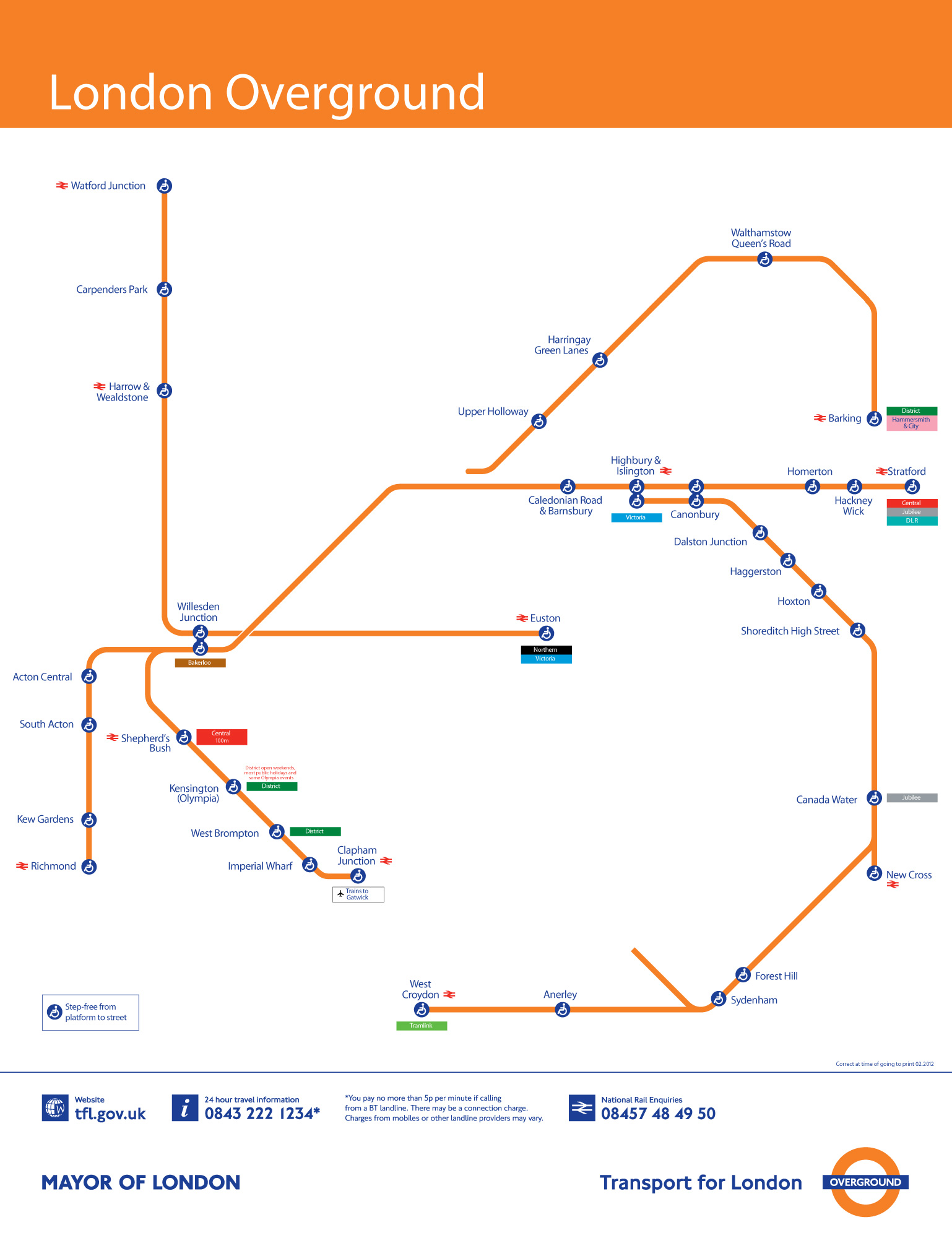
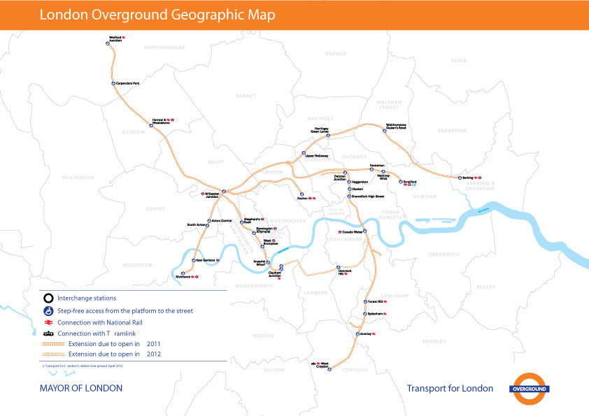
This is the fourth installment of my Accessible Transit Map series. Intended as a replacement map for those with disabilities, this map illustrates which station stops on the Transport for London London Overground system is accessible for those with strollers or with a disability.
London Overground, a suburban rail network in the United Kingdom, is part of the National Rail network linking 20 of London’s 32 boroughs. Starting in 2007 Transport for London consolidated different existing rail concessions and extended new trackage to form the London Overground.
As in previous maps, I have removed all stations which are not handicapped accessible. Maps represent corporeal objects, through convenient fictions – a representation which works for a majority of its users. But where are the maps for the disabled or those require additional accessibility? Wouldn’t the mother with newborn in stroller need a different map then those without the need to lug all the accoutrement’s of childhood? Equally, those in a wheelchair require a map different then one which the walking can use. I decided to rectify the situation by editing the maps of major metropolitan transportation systems, in order to create a map for those who are not represented on the official map.
![]()

![]()
![]()
You can download the London Overground Accessible Transit map below – which comes in two versions – Network and Geographic:
- London Overground Accessible Transit Network Map – jpg image, PDF file
- London Overground Accessible Transit Geographic Map – jpg image, PDF file
Other Accessible Transit Maps for your perusal: