For most of us just getting around the major subway systems of the world is difficult enough. What would a transit system look like if you were disabled or in a wheelchair? I became very curious in this and started to collect maps of different transit systems around the world.
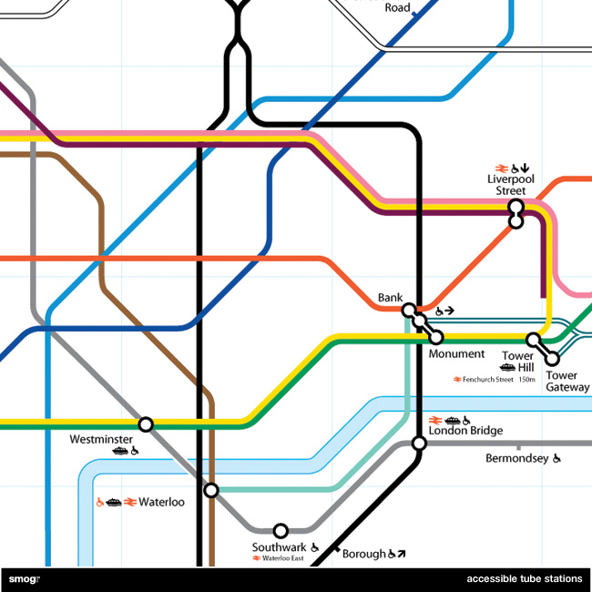
Accessible Transit – London Underground Detail
And then it occurred to me: if maps virtually represent life, through convenient fictions, then why are there no maps for those who are disabled or require additional accessibility? Wouldn’t the mother with newborn in stroller need a different map then those without the need to lug all the accoutrement’s of childhood? Equally, those in a wheelchair require a map different then one which the walking can use. I decided to rectify the situation by editing the maps of major metropolitan transportation systems, in order to create a map for those who are not represented on the official map.
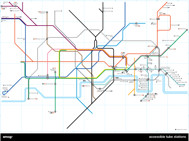
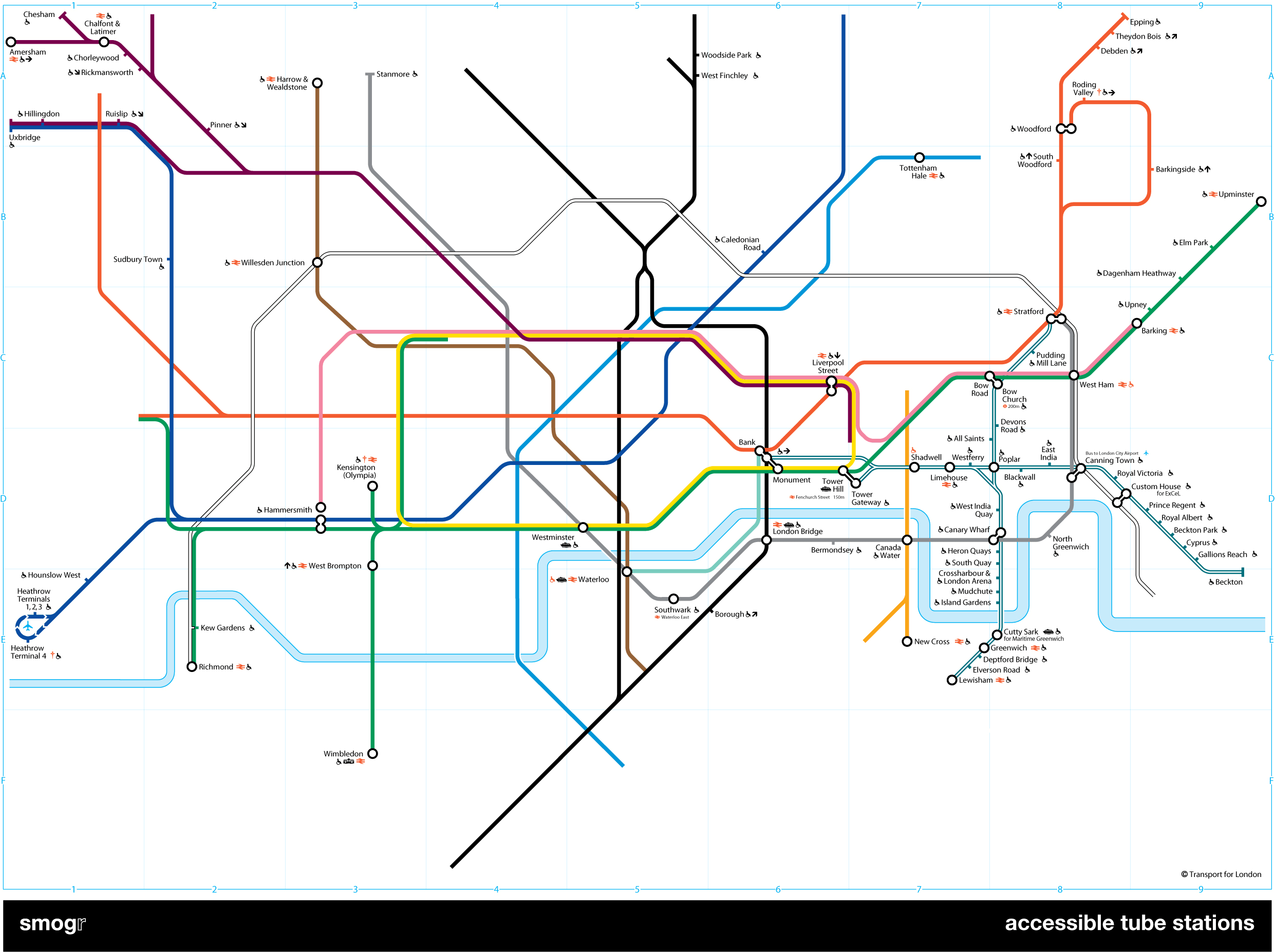
My first Accessible Transit Map was the London Underground map, which can be downloaded in the following versions:
As you can see from the detail below, those of you needing better accessibility have limited options; the DLR and the Jubilee Line are your best choices.
I realize that Transport for London has been making great strides in retrofitting many stations in order to comply with DDA requirements. TfL is doing what they can with hundreds of years old infrastructure and have an extensive transport accessibility system including Dial-a-Ride, which will pick up a disabled person and transport them. They are installing tactile warning surfaces on stairs and at the platform edge, and I’ve noticed the staff is generally helpful to those with disabilities.
But all of this doesn’t change the fact that maps have an intrinsic reality; a reality which those of us with proper ambulatory functions take for granted. Of course Transport for London won’t issue this map as an official Underground map because the map looks really, really bad (not to mention this would be really confusing for the Yank tourists). Not even half of the system’s tube stations – I count 82 out of 275 stations – are accessible.
Lest my reader believes I am picking on the fair city of London, be still. The New York City Subway maps is coming soon; it took longer because the graphics file is horrendously large and difficult to work with.


