Tag: infrastructure
The end of Eastenders causes a 3 gigawatt power surge
Power surges called the TV pickup are unique to Britain. The engineers at the National Grid control centre brace themselves each time Eastenders ends and 1.75 million kettles get switched on.
Mine Kafon; a bamboo tumbleweed that clears landmines
Preliminary notes to a diagram of Occupy Sandy
If I were you, I’d take some time to read Adam Greenfield’s Preliminary notes to a diagram of Occupy Sandy:
Occupy Sandy’s effectiveness constitutes both powerfully impressive testimony as to what ordinary people can achieve when organized in a horizontal, leaderless, distributed and consciously egalitarian network, and a rebuke to the seeming inability of the centralized, hierarchical and bureaucratic organizations to which our society has hitherto entrusted mission-critical disaster recovery functions to cope with what this responsibility demands of them.
Between last week and this, with the cheerful help of everyone I spoke to (and particular thanks to Easton, Lev and Caitlin), I’ve begun to map the process flow at 520 Clinton: to identify the site’s major discrete functions, chart the flow of people, material, information and other resources between them, and identify any blockages or breakdowns in these flows. The rest of this post consists of preliminary notes toward just such a map.
via Preliminary notes to a diagram of Occupy Sandy « Adam Greenfield's Speedbird.
Into the vault: the operation to rescue Manhattan’s drowned internet
Miles of copper is ruined not only in the cable vault at Broad Street, but also at 20 or so manholes around the area. Even worse, paper insulation in the copper wiring sucks water through the cabling from capillary action, destroying cabling even in dry areas. Levendos says it’s “far too tedious, time consuming, and not effective of a process to try and put this infrastructure back together,” so Verizon’s taking the opportunity to rewire with fiber optics instead. Service has been restored to FiOS customers for over a week — unlike copper, fiber optics aren’t damaged by the water. As part of this process, crews have already pulled fiber up the major corridors — including Water, Broad, and Pearl Streets — to ultimately connect the fiber network to buildings.
Into the vault: the operation to rescue Manhattan's drowned internet | The Verge.
Step-Free London Underground Map
I’ve discussed my series of maps called Accessible Transit which removes stations which are not accessible, including systems such as the London Underground, London Overground, New York City Subway. Maps represent corporeal objects, through convenient fictions – a representation which works for a majority of its users. But where are the maps for the disabled or those require additional accessibility? Wouldn’t the mother with newborn in stroller need a different map then those without the need to lug all the accoutrement’s of childhood? Equally, those in a wheelchair require a map different then one which the walking can use. I decided to rectify the situation by editing the maps of major metropolitan transportation systems, in order to create a map for those who are not represented on the official map.
It has come to my attention that Transport for London has a Step Free Tube Guide which illustrates stations where it is possible to get between the platform and street step-free, or change between lines step-free. Stations where this is not possible are shown in a light grey which is nice, but utterly incomprehensible.
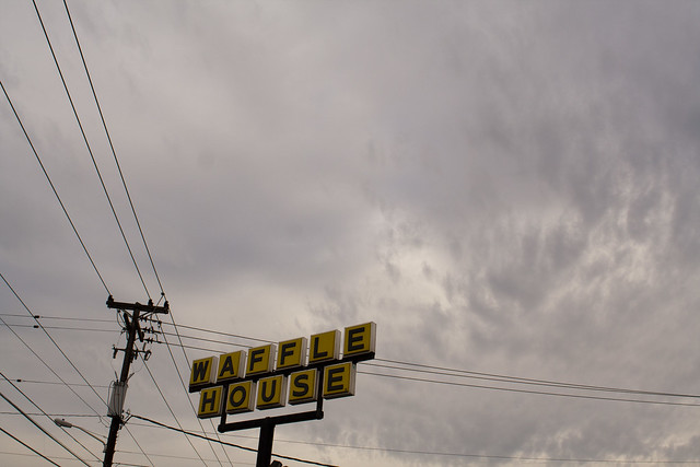
Waffle House Index Measures Hurricane Recovery
The Waffle House Index is an informal metric used by the Federal Emergency Management Agency (FEMA) to determine the impact of a storm and the likely scale of assistance required for disaster recovery:
When a hurricane makes landfall, the head of the Federal Emergency Management Agency relies on a couple of metrics to assess its destructive power.
First, there is the well-known Saffir-Simpson Wind Scale. Then there is what he calls the “Waffle House Index.”
Green means the restaurant is serving a full menu, a signal that damage in an area is limited and the lights are on. Yellow means a limited menu, indicating power from a generator, at best, and low food supplies. Red means the restaurant is closed, a sign of severe damage in the area or unsafe conditions.
via Waffle House Index Measures Hurricane Recovery – WSJ.com.
Panos Kouvelis is the Emerson Distinguished Professor of Operations and Manufacturing Management at Olin Business School and has written about the The ‘Waffle House’ Emergency Level Index:
Both Home Depot and Waffle House are world-class examples in their Disaster Management and Humanitarian Response Planning Approaches. The challenges they face are many: predicting customer demand after a disaster event; providing product required to the affected stores in an accurate and timely manner; establishing appropriate and ethical prices for their products; and maintaining adequate work-force levels after the event. The philosophy of both companies in such situations is more or less the same: getting back into the affected areas, opening stores as quickly as possible, and helping the local economy to rebuild.
As the former Waffle House Restaurants CEO, Bert Thorton, said after a hurricane: “Nothing good can come from a closed Waffle House after a hurricane—not for us, not for the community, not for the associates.” As customers, we couldn’t agree more, and we are grateful for it. We will accept that we cannot get our order of an “over-medium plate scattered, smothered, covered, chunked, diced, topped, peppered, and capped” in their limited menu after the tornado, and we will acknowledge their priceless service of hot meals to law enforcement, emergency responders, and anxious locals.
Kickstarter: Transit App for iOS 6
OpenPlans, a company which builds open source civic infrastructure, collaborating with the public sector to create technology for more efficient, responsive, and inclusive government, has launched a kickstarter drive to create a Transit App for iOS 6 and Beyond:
With the announcement of iOS version 6, Apple has dropped Google Maps and with it, previously built-in support for travel directions via public transit.
With your support, OpenTripPlanner Mobile, an open source application developed by OpenPlans will put transit back on the iPhone. Initially, we will offer coverage for almost all transit systems in North America (see coverage details below).
The app will also add new features that Google Maps didn’t have, allowing users to combine walking, bikes, bike-share and transit together, finding the fastest and most efficient trips regardless of mode of transportation.

Transit App will is now supporting any transit agency in North America that provides open data in the GTFS format. Hundreds of transit agencies already offer this data – check out the current coverage map.
Power Outages Hit 600 Million in India
“We seem to have plunged into another power failure, and the reasons why are not at all clear,” said Gopal K. Saxena, the chief executive of BSES, an electric company that services South Delhi, in a telephone interview. It may take a long time to restore power to north India, he said, because the eastern grid has also failed, and alternate power sources in Bhutan and the Indian state of Sikkim flow into the east first.
Funny thing about the photo in this article: this could be any day, regardless of the power cut. We have power in Mumbai, but who knows if we will keep it on or if the Indian grid will cascade.
Happy 4th of July – How American Got Built: Hulett Automatic Ore Unloader

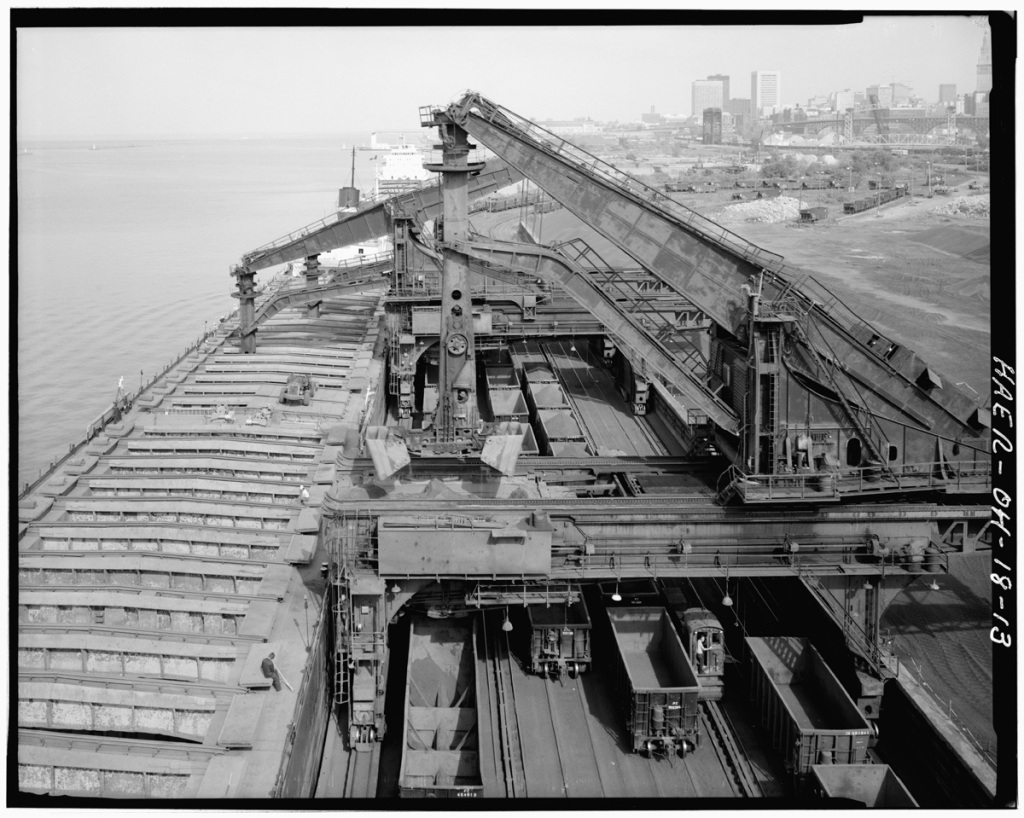
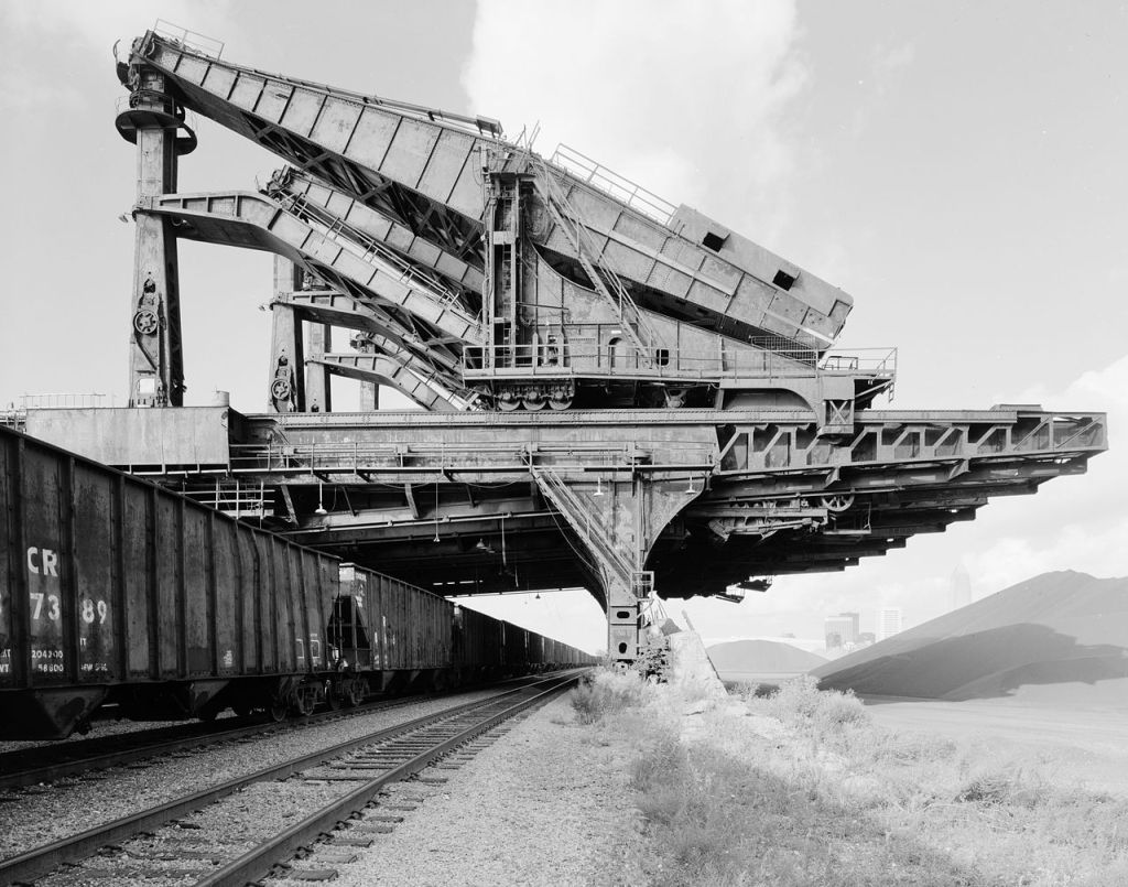
The Hulett Automatic Ore Unloaders once saw wide usage along the Great Lakes unloading bulk ore ships. The Huletts were electrically powered on two parallel tracks along the docks, ordinarily with four railroad tracks in between. A vertical column with a large scoop bucket on the end houses the machine’s operator stationed above the bucket for maximum cargo visibility. The Operator could spin the beam at any angle scooping up to 10 tons of ore per run dumping the load into a moving receiving hopper which ran between the main girders dumping the load into a waiting railroad car.
I vaguely remember seeing the Huletts on Whiskey Island in Cleveland, Ohio when I was a young boy – they were demolished in 2000 after standing idle since 1992 after self-unloading ore ships became the standard on the Great Lakes. So seeing a video of them in operation is amazing: I didn’t realize how big the ore ships were, so the when they strap a front loader to the Hulett bucket and drop it into the ore hold I was dumbfounded.
Below is a video from 1999 from the engine of Amtrak train #44 going under the Huletts on Whiskey Island:
Below is a series of photos from the Library of Congres Pennsylvania Railway Ore Dock, Lake Erie at Whiskey Island collection at the American Memory collection.


