Los Angeles Metro Picks Grimshaw/Gruen team for Union Square Master Plan

As previously reported, the The Los Angeles County Metropolitan Transportation Authority (Metro) Board of Directors voted to approve a contract with Los Angeles-based Gruen Associates in association with Grimshaw Architects of London for the creation of a master plan for the historic Union Station and its surrounding 40 acres.

Metro anticipates signing the contract this summer with the goal of having the master plan completed within 18 to 24 months, or summer 2014. Gruen/Grimshaw has broughttogether a large team of specialist firms from preservation experts to sustainability and technicalconsultants to collaborate on the plan which will be adopted after an approval from the MetroBoard.

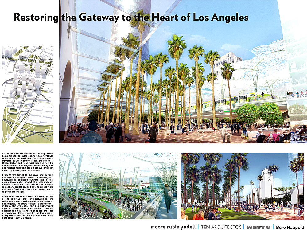
The above “vision board” – a requirement of the RFP created by six different architecture firms – shouldn’t be taken seriously, as LA Metro’s own release states that “while there will be no detailed architectural design involved with this master plan, Grimshaw is expected to bring architectural vision to the process.” Hopefully this won’t turn into another World Trade moment where the master planner is kicked off the project. I have great respect for Grimshaw and their work, and hope they can help knit the center of Los Angeles back together.

Los Angeles Union Station Master Plan “Vision Boards”

In April 2011, Metro completed the acquisition of Union Station and the approximately 40 acres surrounding the historic rail passenger terminal. As part of the Los Angeles Union Station Master Plan, the six short-listed teams were required to submit one Vision Board showing a high-concept vision for Union Station in the year 2050. The Vision Boards are not part of the formal evaluation process, but rather a means to begin the public engagement process and ignite inspiration about Union Station as a multi-modal regional transportation hub. The Vision Boards were presented to the public at a viewing event on April 25th, 2012.

The short listed teams all include multiple firms, and are led by the following prime contractors:

  • EE&K a Perkins Eastman Company/UNStudio
  • Gruen Associates/Grimshaw Architects
  • IBI Group/Foster+Partners
  • Moore Ruble Yudell Architect and Planners/Ten Aquitectos/West 8
  • NBBJ/ingenhoven Architects
  • Renzo Piano Building Workshop (RPBW)/ Parsons Transportation Group

All six teams are required to do the following during the master planning phase:

  1. Data Collection and Analysis
  2. Preparation of Draft Alternatives
  3. Final Preferred Plan and Implementation Strategies
  4. Public Outreach (throughout the process)
  5. Project Administration (throughout the process)

Metro is in the evaluation process and will bring a recommendation for the USMP consultant team to the Board of Directors on June 28th, 2012 with public announcement on or around June 17th.

Below are the Vision Boards:

KCRW interviews Moby on LA architecture

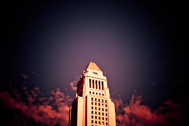
Los Angeles City Hall

Chances are, you know Moby best for his electronic dance music. But it turns out the eclectic-minded musician has another life, as an architecture buff who recently moved to LA and now writes a blog about buildings here he loves. The blog is called, simply, Moby Los Angeles Architecture Blog, and features his photos of local architecture—from commonplace courtyard apartments to iconic houses by Frank Lloyd Wright—as well as his musings on the urban environment. Frances Anderton talks to Moby about his love of architecture.

Los Angeles v New York City: Which One is more Dense? You would be surprised…

The US Census Bureau has begun to release findings from the 2010 Census, showing a considerable Growth in Urban Population Outpaces Rest of Nation:

The nation’s most densely populated urbanized area is Los Angeles-Long Beach-Anaheim, Calif., with nearly 7,000 people per square mile. The San Francisco-Oakland, Calif., area is the second most densely populated at 6,266 people per square mile, followed by San Jose, Calif. (5,820 people per square mile) and Delano, Calif. (5,483 people per square mile). The New York-Newark, N.J., area is fifth, with an overall density of 5,319 people per square mile.

What is interesting to me, is that using the MSA, which we have talked about before (Metropolitan and Micropolitan Statistical Areas), but it is helpful to remember that the OMB defines MSA’s as, “one or more adjacent counties or county equivalents that have at least one urban core area of at least 50,000 population, plus adjacent territory that has a high degree of social and economic integration with the core as measured by commuting ties.” Below is a comparison of the Los Angeles MSA (on the left) with the New York MSA on the right, along with data from the 2010 Census:

Los Angeles and New York City MSA, 2010 Census.
Dark poche indicates urbanized area or urban cluster of 10,000 or more
MSA Population Area Density
Los Angeles:
LA, Long Beach, Anaheim
12,150,996 people 1,736.02 sq. miles 6,999.3 people per sq. mile
New York:
NYC, Newark, Bridgeport
18,351,295 people 3,450.2 sq. miles 5,318.9 people per sq. mile

As you can see, the New York MSA is almost twice as big in land area as the Los Angeles MSA. If we look back up to the definition of a MSA, specifically the part about a high degree of social and economic integration with the core as measured by commuting ties, this makes sense: New York’s subway and commuter rail is magnitudes bigger and more effective than Los Angeles.

There is no doubt that the less dense suburban areas of Connecticut, New Jersey and Long Island bring down the top-line density figure. In this case, the MSA comparison hides more than it reveals: while LA is undoubtable denser than popular notions give it credit for, the more complete transportation system of New York creates a larger livable catchment area.

Also see Nate Berg’s article, U.S. Urban Population Is Up … But What Does ‘Urban’ Really Mean?.