Transit Elevated Bus: That’s not a bus, it’s a big train

teb-1

In the last few months, an idea in search of a solution, has emerged from China: a giant car-straddling bus which would soar above waiting traffic below. Which sounds awesome; I’ve been to Beijing – the ring roads are some of the most congested pavement on earth. Let’s go to the grey lady with, China’s Straddling Bus, on a Test Run, Floats Above Streets:

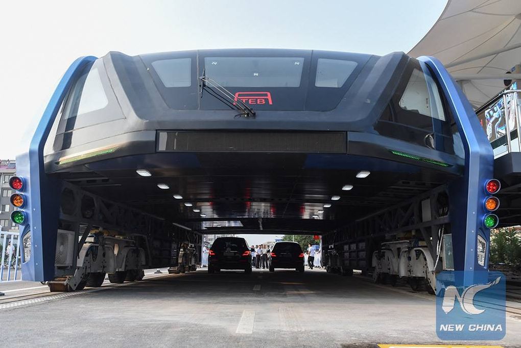
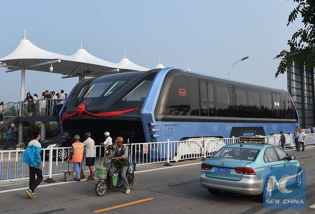
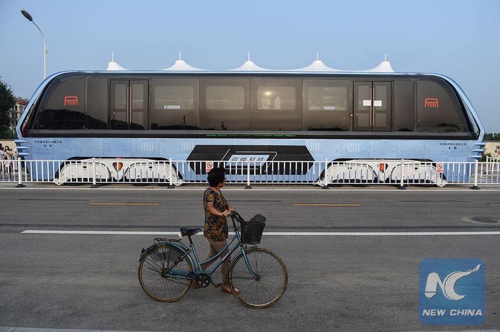
If you’re driving in a Chinese city in the none-too-distant future and your car is engulfed in a smooth, humming metallic belly, don’t panic. It may feel like an alien abduction, but probably it’s only a colossal, street-straddling bus.

The idea of a bus so large, high and long that it could virtually levitate above congested streets seemed surreal when presented at an expo in Beijing in May. But it came a step closer to reality this week, when a prototype went for an experimental spin in Qinhuangdao, a seaside city in northern China.

But having about 7 feet of vertical clearance for cars to go underneath feels like a disaster waiting to happen. And this isn’t a bus – it’s a new type of light rail vehicle. You can see the running rails on either side of the vehicle, below:

teb-4

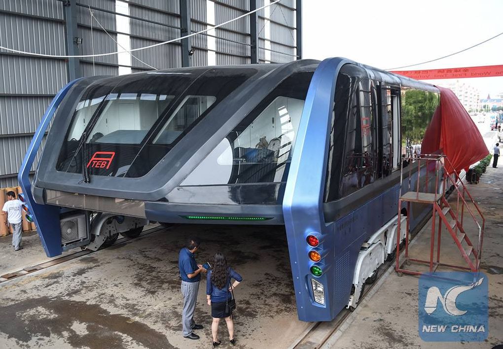
It appears that the rail system is a running guide rail and the propulsion is by rubber tires, very similar to Paris Metro rubber tire subway cars.

teb-3If the goal is to densify the street and overlay many different modes of transport, this might be your ticket. It is interesting if you don’t have the time or money to build heavy rail or subway system, or don’t have the right of way to build surface rail. This feels like a solution when your constraint is to not reduce vehicle miles traveled in low-occupancy vehicles, or you cannot densify a lane of traffic by using light rail or even high-value bus rapid transit.

Putting my pendant hat on: let’s stop calling this a bus (because it isn’t).


teb-2

Cartography Police

On the front page of the Times of India, is the following piece, US state department shows PoK as part of Pakistan:

At a time when incorrect India maps are getting the goat of not just the government but also journalists, there is even more alarming news for India’s strategic community. The official website of US department of state, which handles foreign relations of the country, shows PoK as part of Pakistan, notwithstanding India’s claim over the region.

In the case of India, however, the map differs from the official Indian map in that it completely ignores India’s claim over PoK by not even acknowledging its disputed status.

“It shows a distinct pro-Pakistan cartographic tilt that is inconsistent with the UN projection of the entire PoK (including Gilgit-Baltistan) as disputed,” strategic affairs expert Brahma Chellaney said.

The offending map is nary to be found on the State website (but is reprinted above and at the CIA Factbook on India), so it undoubtably has been seen as a diplomatic slight and is being fixed. If you want to learn more about how and what this is all about, check out this abridged Wikipedia list:


The Yoruba say that lines hove power. “This country has become civilized” literally means “This earth has lines upon its face.” Ilàjú in Yoruba means both “Civilization” and face with lined marks. The line on a body is the city, the polis, the civilization.

I can understand, if not completely internalize the sentiment of this article. I don’t want to step into this longstanding 64+ year long argument, especially after a colleague chastised me when I was drawing the map of India and left off the PoK. My colleague yelled, “You left the crown off the top! Are you some kind of Pakistani cartographer?” While it was good natured, the admonishment stayed with me, revealing a topic which is better left not discussed as a foreign visitor.

Note that this isn’t just about lines on a map, even if this week’s Economist has been censored due to showing the disputed area of Kashmir (see also Fantasy frontiers which explains the territorial claims). Rather there are both nationalistic reasons for disputing the borders, but also physical reasons: natural resources. Don’t miss the epic Economist article, Unquenchable thirst, A growing rivalry between India, Pakistan and China over the region’s great rivers may be threatening South Asia’s peace:

The river swirls away, white-crested and silt-laden, racing to the nearby border with Pakistan. But there Baglihar is a source of bitterness. Pakistanis cite it as typical of an intensifying Indian threat to their existence, a conspiracy to divert, withhold or misuse precious water that is rightfully theirs. Officials in Islamabad and diplomats abroad are primed to grumble about it. Pakistan’s most powerful man, the head of the armed forces, General Ashfaq Kayani, cites water to justify his “India-centric” military stance.

Others take it further. “Water is the latest battle cry for jihadis,” says B.G. Verghese, an Indian writer. “They shout that water must flow, or blood must flow.” Lashkar-e-Taiba, a Pakistani terror group, likes to threaten to blow up India’s dams. Last year a Pakistani extremist, Abdur Rehman Makki, told a rally that if India were to “block Pakistan’s waters, we will let loose a river of blood.”